Trail projects To learn more about the Mountain Stewards’ Indian Trails and Trail Tree projects, or to notify the group of a potential trail tree, visit www.mountainstewards.org.
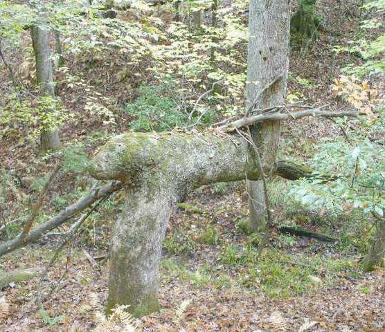
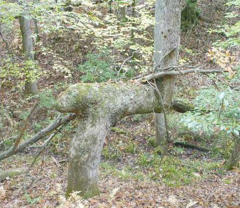
While working to build trails in Northeast Georgia, a group of area hikers stumbled down a path that would lead them on a historical scavenger hunt across the country. The hidden treasure: Trails created hundreds of years ago by Native Americans, which are seemingly marked by curiously bent, or marker, trees. "When we first started all of this, we thought all of the marker trees we found were done only by Cherokee Indians and were only in Northeast Georgia," said Don Wells, president of the Mountain Stewards organization, during a recent meeting of the Georgia Chapter of the Trail of Tears Association at North Georgia College & State University in Dahlonega. "What we later found as we started building this program and comparing notes with other groups, is that it is much more widespread. All of the tribes did it." In 2003, Mountain Stewards, a nonprofit, was formed by a group of hikers who were interested in restoring and building hiking trails in Dawson, Pickens and Gilmer counties. While doing so, they began to take note of what seemed to be random trees that had abrupt bends in the trunks. Through talking with elders in the communities where the trees were found, the group’s members were able to gather some background knowledge about the trees, Wells says. "They are pointers in a sense. Some point to a sacred site and others could mark boundaries," Wells said. "In the Bankhead National Forest in Alabama, two trees were found that point out in different directions. "There was a major battle at this site between the Creek and Chickasaw (tribes), and they believe that the trees point to where the graves are." Then there are trees like the one found on a farm in Arkansas that points to a spring, or the ones in Dawson County that point to an area that has been determined to be a former Cherokee village, Wells says. Gainesville resident James Stewart, a researcher with the mountain group, says he has located about 100 marker trees across Hall, Dawson and Lumpkin counties. "I’ve been finding quite a few in the north Hall area," Stewart said. Locally, Stewart says he’s located marker trees near Candler Highway, in Chicopee Woods and off Mountain View Road. "When you go into the undisturbed areas, you find more of these trees," Stewart said. Although some trees have been disfigured by nature, researchers say there are a few key signs that differentiate the man-made bends from the natural ones. "When I go out, I’m looking for a tree that has a right angle with that characteristic nose on the end," Stewart said. "The nose shows where the original trunk was growing straight up." The Mountain Stewards have been comparing the location of the marker trees with historical records that document the location of Native American villages and their routes of travel. These points are being used to create a historical trails map. Although a local tie hasn’t been established yet, Wells says researchers in Illinois have linked some of the unearthed routes to the Trail of Tears. According to the National Park Service, the Trail of Tears is the route travelled by thousands of Native Americans in the 1830s when they were removed from their homelands in Tennessee, Alabama, North Carolina and Georgia and relocated to Oklahoma. In addition to continuing their mission to locate more marker trees, the stewards are trying to learn more about the curiosities. One of the big questions the group has is how the trees were bent in the first place. "There are other features, like knobs on the hip of the tree, that are like a story on a story," Wells said. "We’re a long ways from finishing." Some of the group’s findings will be released later this year in a book.

