
(This article will be updated thoughout the day as developments warrant.)
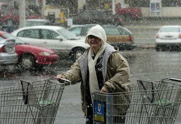
At 4 p.m., the temperature in Gainesville was 34 degrees and light snow was falling. Roads are still passable in the county, but officials urge people to stay home anyway. Temperatures will plummet and today's snowfall will freeze over and cause icy road conditions by Sunday morning.
The National Weather Service has issued a snow advisory for north and west central Georgia, generally north along a line from Hamilton to Griffin to Madison to Lexington. The advisory area includes Gainesville and Northeast Georgia.(An earlier heavy snow warning has been canceled.)
The snow advisory is in effect until 7 p.m. tonight, when the snow will begin to taper off.
With snow falling steadily but little accumilation on roads, Hall County public safety workers were getting few calls this afternoon.
"It’s been a slow day so far,” said Scott Cagle, spokesman for the Hall County Fire Services, which responds to the majority of emergency calls in the county. “Everybody’s been staying in for the most part.”
Likewise, the Hall County Sheriff’s office wasn’t seeing many wrecks, Maj. Jeff Strickland said.
"We don’t have any wrecks working right now,” Strickland said at 1:30 p.m., about two and a half hours after a moderate to heavy snow began falling in Gainesville.
Tonight’s predicted freezing temperatures, and the potential for “black ice” on the roads, is what has public safety officials concerned.
"We’re not worried about the snow,” Cagle said. “With the temperatures in the teens coming tonight, that’s what we’re really concerned about.”
Said Strickland, “We would urge anyone to stay off the roads tonight unless it’s an emergency.”
Forecasters said the temperature would hover near freezing during the daytime hours, and the difference of a few degrees cooler or warming would significantly impact the amount of snow that accumulates.
The heaviest accumulations, up to 3 inches, are likely in the advisory area, the weather service said.
A snow advisory means that periods of snow will cause primarily travel difficulties. Be prepared for snow covered roads and limited visibilities, the weather service said.
So far, the snow has caused few problems.
Georgia Department of Transportation spokesman Rick Parham said the agency had 180 workers on standby early Saturday, but did not call them in until mid-morning when the snow began to fall.
He said another crew will begin a 12-hour shift at 6 p.m. He expects that crew will have the most difficult task as any snow or other moisture remaining on the roads is expected to freeze as temperatures plummet.
Parham said that unlike most winter storms in Georgia, the most significant accumulation is going to be in areas South of Gainesville, rather than in the mountains.
The DOT has two shifts of 110 trucks monitoring more than 2,500 centerline miles of state roads and interstates in 21 Northeast Georgia counties, said Teri Pope, communications officer for the DOT.
As of Friday afternoon, only two roads had been closed in the area. Ga. 180 Spur, the road that leads up to Brasstown Bald, and Ga. 348 at Hogpen Gap have been closed to traffic since Wednesday afternoon. Those roads will likely stay closed until next week.
Utilities were reporting no outages at noon.
Susan Baker, marketing communications specialist for Habersham EMC, reported no weather-related outages for its customers.
But the company, which services Habersham, White and North Hall counties, is keeping a close watch on the weather as temperatures keep dropping.
"It's (the snow) is starting to stick to the trees," said Baker. "That's when you have the weather-related outages is when it sticks to the trees."
Bonnie Jones, director of public relations and communications for Jackson EMC, said no outages have been reported. In fact, the electric company has not even implemented its emergency restoration plan, because snow does not usually affect power lines.
"Right now, we're clean and clear," Jones said.
Jones said the company is keeping watch for problems that may occur tonight as drivers venture out onto the icy roads, possibly slipping off the road and hitting power lines.
Times staffers Mitch Clarke, Ashley Fielding, Stephen Gurr and Harris Blackwood contributed to this report.