

Threats of heavy rain, high winds and potential storm damage resulting from Hurricane Florence have eased for Northeast Georgia, according to the latest update from the National Weather Service at 1 p.m. Thursday, Sept. 13.
But rainfall between 2-4 inches could be seen across the region between Saturday and Monday as the storm pushes east and then north from the North Carolina-South Carolina coast, with sustained winds between 20-25 mph and gusts up to 40 mph.
Local school districts, government and public safety agencies remain on standby.
Casey Ramsey, Hall County’s interim emergency management agency director, said he does not expect to activate the emergency operations center for the storm – at least at this time.
But a final determination will be made Saturday as the hurricane pushes into the region.
Though the hurricane’s force is expected to decrease in intensity and weaken as it approaches Georgia according to the weather service, flooding is possible in the farthest reaches of Northeast Georgia.
Locally, a heavily saturated ground could bring down trees and, subsequently, threaten to cut power service to some residents.
Chris Rotalsky, Gainesville’s public works director, said the latest forecast “doesn’t change our plan significantly.”
His agency is still in preparation-mode, he added, which includes getting staffing and resources in place for the worst-case scenario while continuing to monitor the forecast.
Gordon Higgins, spokesman for Hall County Schools, said officials are focused mostly at this time on how the weather will impact extracurricular travel and field trips over the weekend and into early next week.
“Those are the things we’re looking at right now,” he added. “It seems every day there’s a different forecast. A lot of it is just going to depend (on the weather).”
Gainesville City Schools Superintendent Jeremy Williams said, “We’ll evaluate the situation during the weekend, but we anticipate a regular day on Monday.”
The school district had to cancel five school days about this time last year when the severity of Hurricane Irma was felt locally.
“Power outages are the largest threat to us,” Williams said. “With our district providing free breakfast and lunch to all students, our goal is to be open.”
Meanwhile, Jerry Deyton, pastor and founder of The Way homeless ministry in Gainesville, said he is also staying on top of the latest forecasts and may open his day-center for overnight guests if the rain and winds are severe enough come Sunday and Monday.
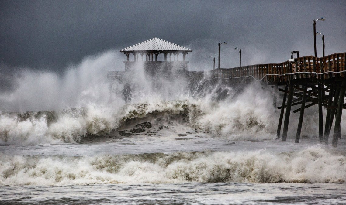

Hurricane Florence’s leading edge battered the Carolina coast Thursday, bending trees and shooting frothy sea water over streets on the Outer Banks, as the hulking storm closed in with 100 mph winds for a drenching siege that could last all weekend.
Forecasters said conditions will only get more lethal as the storm pushes ashore early Friday near the North Carolina-South Carolina line and makes its way slowly inland.
Its surge of ocean water could cover all but a sliver of the Carolina coast under as much as 13 feet, and days of downpours could unload more than 3 feet of rain, touching off severe flooding.
Florence’s winds weakened as it drew closer to land, dropping from a peak of 140 mph earlier in the week, and the hurricane was downgraded from a terrifying Category 4 to a 2.
But given the storm’s size and sluggish track, forecasters said it could cause epic damage akin to what the Houston area saw during Hurricane Harvey just over a year ago, with floodwaters swamping homes and businesses and washing over industrial waste sites and hog-manure ponds.
“It truly is really about the whole size of this storm,” National Hurricane Center Director Ken Graham said. “The larger and the slower the storm is, the greater the threat and the impact — and we have that.”
The Associated Press contributed to this story.