Tornadoes, large hail and strong winds are in the forecast between 3 p.m. and midnight on Monday, March 19.
Hall County Schools have decided to wrap up all school events by 7 p.m. as a precaution.
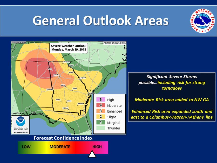
The National Weather Service is warning Georgians about severe thunderstorms across the state to start the week. The worst of the storms will hit Northwest Georgia on Monday, but the entire state is under an advisory. Metro Atlanta and South Hall are now included in the zone of “enhanced risk” for severe storms.
“As usual, we’re on the line,” said Casey Ramsey, interim director of the Hall County emergency management agency, after a 1 p.m. storm briefing from the National Weather Service in Peachtree City.
Primary threats include tornadoes, “very large hail” of up to 2 inches — or about the size of a hen’s egg — winds stronger than 60 mph and frequent lightning, according to the National Weather Service.
Tornadoes, hail, wind, lightning possible this evening; Hall schools to end events by 7 p.m.
Severe weather expected from 3 p.m. to midnight